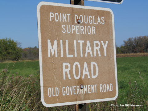
Point Douglas Superior to Military Road
Old Government Road
Military Road and Byway Route Map
Listen:
Audio clip: Adobe Flash Player (version 9 or above) is required to play this audio clip. Download the latest version here. You also need to have JavaScript enabled in your browser.
The Old Government Road, also known as the Point Douglas Superior Military Road, begins where the waters of the St. Croix and the Mississippi rivers meet. Construction began in 1852 and final government financing was received in 1858.
 Although the road was never 100 percent completed, it served as a transporation route for settlers moving inland and for the U.S. mail service.
The first U.S. mail service was carried on horseback and afoot early in 1856. Stage service had begun by 1861 and continued until 1870. The road was used until the Lake Superior and Mississippi Railroad opened its line connecting St. Paul and Duluth.
Many areas of the St. Croix Scenic Byway travel on or near the section of land that was once part of the 185 mile Government Road, including about 15 miles of state Highway 95 between Stillwater and Taylors Falls.
